CEM

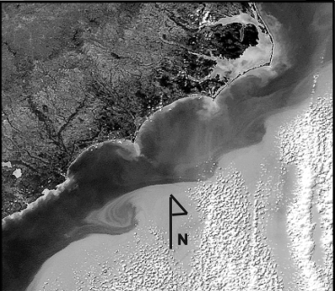
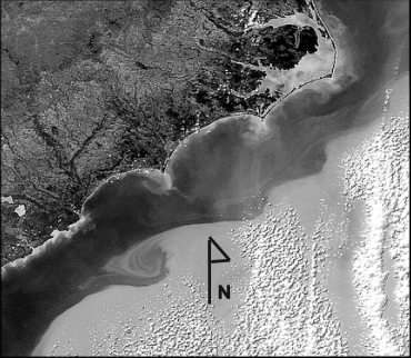
The Coastline Evolution Model (CEM) addresses predominately sandy, wave-dominated coastlines on time-scales ranging from years to millenia and on spatial scales ranging from kilometers to hundreds of kilometers. Shoreline evolution results from gradients in wave-driven alongshore sediment transport. At its most basic level, the model follows the standard 'one-line' modeling approach, where the cross-shore dimension is collapsed into a single data point. However, the model allows the plan-view shoreline to take on arbitrary local orientations, and even fold back upon itself, as complex shapes such as capes and spits form under some wave climates (distributions of wave influences from different approach angles). The model can also represent the geology underlying the sandy coastline and shoreface in a simplified manner and enables the simulation of coastline evolution when sediment supply from an eroding shoreface may be constrained. CEM also supports the simulation of human manipulations to coastline evolution through beach nourishment or hard structures.

coastal evolution

Alias

Coastline evolution model

Contributor(s)

Initial contribute: 2021-09-08

Authorship

:  
Duke University
:  
abmurray@duke.edu
Is authorship not correct? Feed back

Classification(s)

Application-focused categoriesNatural-perspectiveLand regions

Detailed Description

English {{currentDetailLanguage}} English

We first briefly discuss the model we use for this evaluation, 2004; Ashton et al., 2001]. When waves break at a shoreline, they drive a flux of sediment along the shore. The magnitude of this flux is related to the breaking-wave height, and to the wave approach angle, relative to the shoreline orientation. Alongshore sediment fluxes, Qs, are based on the commonly used CERC equation [Komar and Inman, 1970; Komar, 1998]:


Where Hb and \( ∅ \)b are breaking-wave height and crest angle, respectively, and \( θ \) is local shoreline orientation. K1 is an empirical constant equal to 0.4 m1/2/s for the sandy coastline considered here. 

Quoted from : Coastline responses to changing storm patterns

模型元数据

{{htmlJSON.HowtoCite}}

{{htmlJSON.Copy}}

Contributor(s)

Initial contribute : 2021-09-08

{{htmlJSON.CoContributor}}

Authorship

:  
Duke University
:  
abmurray@duke.edu
Is authorship not correct? Feed back

History

Last modifier
Yihan Zhang
Last modify time
2021-09-08
Modify times
View History

QR Code

×

{{curRelation.overview}}
{{curRelation.author.join('; ')}}
{{curRelation.journal}}


{{htmlJSON.RelatedItems}}

{{htmlJSON.LinkResourceFromRepositoryOrCreate}}{{htmlJSON.create}}.

Drop the file here, orclick to upload.
Select From My Space
+ add

{{htmlJSON.authorshipSubmitted}}

Cancel Submit
{{htmlJSON.Cancel}} {{htmlJSON.Submit}}
{{htmlJSON.Localizations}} + {{htmlJSON.Add}}
{{ item.label }} {{ item.value }}
{{htmlJSON.ModelName}}:
{{htmlJSON.Cancel}} {{htmlJSON.Submit}}
名称 别名 {{tag}} +
系列名 版本号 目的 修改内容 创建/修改日期 作者
摘要 详细描述
{{tag}} + 添加关键字
* 时间参考系
* 空间参考系类型 * 空间参考系名称

起始日期 终止日期 进展 开发者
* 是否开源 * 访问方式 * 使用方式 开源协议 * 传输方式 * 获取地址 * 发布日期 * 发布者


编号 目的 修改内容 创建/修改日期 作者


时间分辨率 时间尺度 时间步长 时间范围 空间维度 格网类型 空间分辨率 空间尺度 空间范围
{{tag}} +
* 类型
图例


* 名称 * 描述
示例描述 * 名称 * 类型 * 值/链接 上传


{{htmlJSON.Cancel}} {{htmlJSON.Submit}}
Title Author Date Journal Volume(Issue) Pages Links Doi Operation
{{htmlJSON.Cancel}} {{htmlJSON.Submit}}
{{htmlJSON.Add}} {{htmlJSON.Cancel}}

{{articleUploading.title}}

Authors:  {{articleUploading.authors[0]}}, {{articleUploading.authors[1]}}, {{articleUploading.authors[2]}}, et al.

Journal:   {{articleUploading.journal}}

Date:   {{articleUploading.date}}

Page range:   {{articleUploading.pageRange}}

Link:   {{articleUploading.link}}

DOI:   {{articleUploading.doi}}

Yes, this is it Cancel

The article {{articleUploading.title}} has been uploaded yet.

OK
{{htmlJSON.Cancel}} {{htmlJSON.Confirm}}
QD3odeEL3cP0