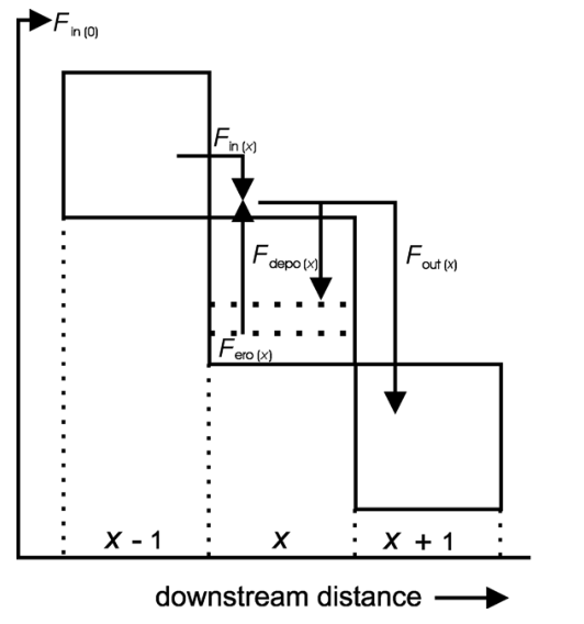
A 2-D process– response model, AQUATELLUS, has been designed that integrates fluvio-deltaic process descriptions for large spatial and temporal scales. Over large (geological) time scales, major floods and storms are the relevant transport events. A large spatial scale is chosen and a typical longitudinal profile extends over 10 –100’s of kilometres. This still is an order of magnitude smaller than classical basin models (e.g.Steckler et al., 1993; Flemings and Grotzinger, 1996). The chosen macroscopic scale requires simplification of process descriptions while on the other hand the dynamic nature of the processes requires a certain degree of freedom. The essence of the approach is integration of a mass balance that transforms spatial differences in sediment transport to rates of erosion or deposition over time. The sediment transport rates respond dynamically to changes in topography and depositional environment as a con- tinuity equation (modified afterKirkby, 1992; V eld- kamp and van Dijke, 1998, 2000; Tebbens et al., 2000; Storms et al., 2002). We model the system as a semiclosed system. A longitudinal profile is seen as a ‘hose’ that transports incoming sediment down- stream. The lower boundary condition for sediment flux is undefined.
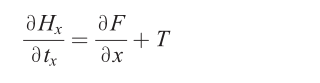
The upper boundary conditions are specified as input(see under model input):

where:H= topographical height [L];t=t i m e [ T ] ; F= sediment flux [L2T?1];T= rate of vertical tectonic movement [L T?1];x= horizontal distance [L].
The sediment flux gradient, which is the spatial derivative of the sediment flux, is described as the resultant of the erosion and sedimentation fluxes (Eq. (2),Fig. 1). Erosion flux (Eq. (3)) and sedimentation flux (Eq. (5)) are described conceptually different, which is the main conceptual difference to diffusion- based models (e.g.Rivenaes, 1992; den Bezemer, 1998).
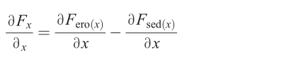
where:Fero= erosion flux [L2T?1];Fsed= sedimenta- tion flux [L2T?1].Theerosion fluxdepends on the stream power, which is determined by discharge and local slope. This approach has been used byTucker and Slingerland (1994)andKooi and Beaumont (1996)for the upper reach
of river systems, where erosion is the dominant process.
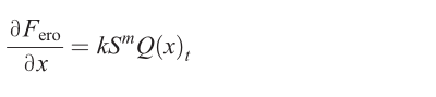
where:Q(x) = discharge function [L2T?1];S= slope [L L?1];m=c o n s t a n t [–] ;k= erosion efficiency [L?1].
The discharge functionQ(x) differs for fluvial and marine environments. In the fluvial domain, discharge increases downstream, reflecting an increasing con- tributing drainage area. Offshore,Q(x) decreases with increasing water depth, mimicking the effect of decreasing fluvial influence in the marine basin due to lateral spreading of the deltaic plume(Albertson et al., 1950; Wright, 1977; Nemec, 1995; Morehead and Syvitski, 1999). The constantmis chosen equal to 1 in the fluvial domain, to obtain a linear slope-depend- ent relation. In the marine domain,mis set to be equal to 0, making erosion essentially slope-independent. Erosion due to wave action is not incorporated. We consider these assumptions valid for the specific low- gradient setting, and because we do not model the shelf edge.
Quoted from : Modelling Holocene stratigraphy and depocentre migration of the V olga delta due to Caspian Sea-level change