quoted from:https://csdms.colorado.edu/wiki/Model:FACET
FACET is a Python tool that uses open source modules to map the floodplain extent and derive reach-scale summaries of stream and floodplain geomorphic measurements from high-resolution digital elevation models (DEMs). Geomorphic measurements include channel width, stream bank height, floodplain width, and stream slope.
Current tool functionality is only meant to process DEMs within the Chesapeake Bay and Delaware River watersheds. FACET was developed to batch process 3-m resolution DEMs in the Chesapeake Bay and Delaware River watersheds. Future updates to FACET will allow users to process DEMs outside of the Chesapeake and Delaware basins.
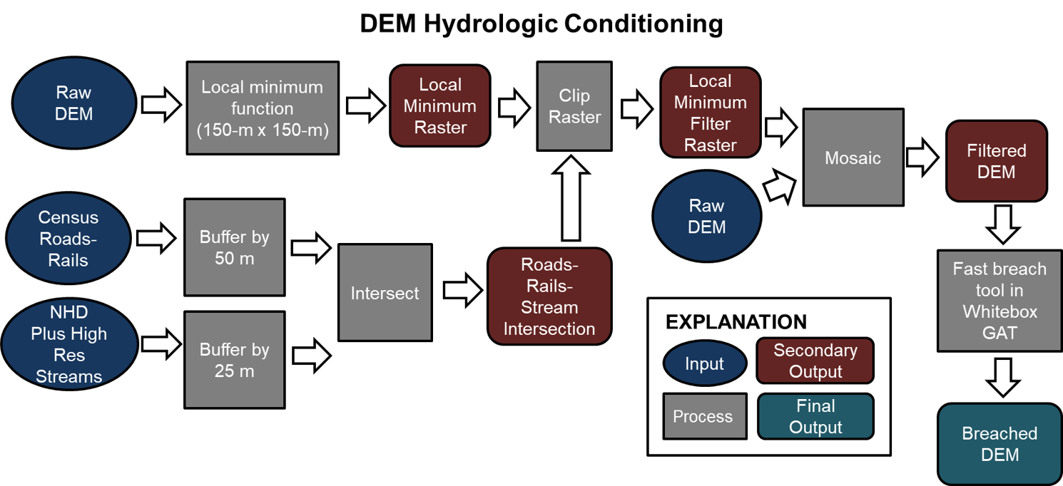
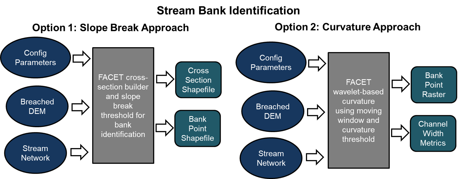
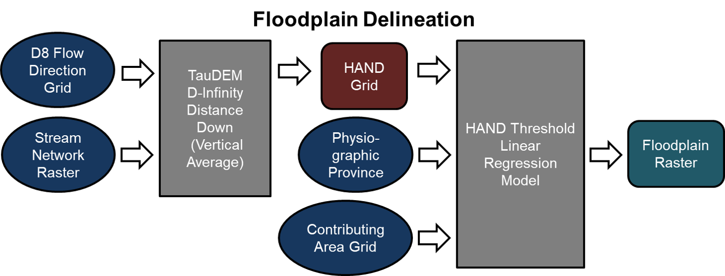
FACET allows the user to hydrologically condition the DEM, generate the stream network, select one of two options for stream bank identification, map the floodplain extent using a Height Above Nearest Drainage (HAND) approach, and calculate stream and floodplain metrics using three approaches.