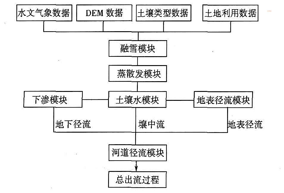
TOPKAPI model simulates the spatial distribution of basin characteristic parameters, precipitation and hydrological response with orthogonal grid system (DEM grid) and horizontal soil column corresponding to each grid in horizontal and vertical directions respectively. It is based on the combination of kinematic method and watershed topography. Watershed topography is described by digital elevation model (DEM), which subdivides the study area with square grid, and the grid size changes with the scale of the study area or problem. Each cell is a calculation node reflecting the physical characteristics of the model (mass balance and momentum balance). The runoff route and slope are estimated according to the maximum elevation difference between adjacent units in DEM.
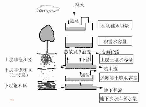
In the TOPKAPI model, the soil is vertically divided into two layers. The upper unsaturated area can be understood as the rainfall runoff calculation layer in the rainfall runoff model, and the hydraulic conductivity of the upper soil is better than that of the lower soil; the lower layer includes two soil layers, namely, the lower unsaturated zone and the lower saturated zone. Part of the water infiltrates from the upper soil to the unsaturated soil layer of the lower layer, and then infiltrates to the saturated soil layer of the lower layer, and moves horizontally in the saturated soil layer. When the groundwater level rises to the upper soil, the unsaturated soil layer disappears temporarily.
[1]李致家,王秀庆,吕雁翔,陈利者,李兰茹.TOPKAPI模型的应用及与新安江模型的比较研究[J].水力发电,2013,39(11):6-10.
[2]Numerical algorithm of distributed TOPKAPI model and its application[J].Water Science and Engineering,2008,1(04):14-21.