MODPATH

MODPATH version 7 is the fourth major release since its original publication.

groundwater

Contributor(s)

Initial contribute: 2019-06-28

Authorship

:  
modflow@usgs.gov
Is authorship not correct? Feed back

Classification(s)

Application-focused categoriesNatural-perspectiveLand regions

Detailed Description

English {{currentDetailLanguage}} English

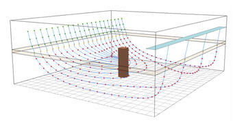
MODPATH version 7 is the fourth major release since its original publication. Previous versions were documented in USGS Open-File Reports 89-381 and 94-464 and in USGS Techniques and Methods 6-A41. The current release of MODPATH version 7 (7.2.001) works with MODFLOW-2005MODFLOW-USG, and MODFLOW-6. Support for unstructured grids in MODFLOW-USG and MODFLOW-6 is limited to smoothed, rectangular-based quadtree and quadpatch grids. In addition to unstructured grid support, input and output formats for MODPATH also have been modified to minimize the difference between MODPATH simulations based on the different versions of MODFLOW.

Note:  MODPATH version 7 only works with quadtree and quadpatch grids if they have a north-south orientation

Software License and Purchase Information

This software is a product of the U.S. Geological Survey, which is part of the U.S. Government.

Cost

This software is freely distributed. There is no fee to download and (or) use this software.

License

Users do not need a license or permission from the USGS to use this software. Users can download and install as many copies of the software as they need.

Public Domain

As a work of the United States Government, this USGS product is in the public domain within the United States. You can copy, modify, distribute, and perform the work, even for commercial purposes, all without asking permission. Additionally, USGS waives copyright and related rights in the work worldwide through CC0 1.0 Universal Public Domain Dedication (https://creativecommons.org/publicdomain/zero/1.0/ ).


模型元数据

{{htmlJSON.HowtoCite}}

USGS MODFLOW Team (2019). MODPATH, Model Item, OpenGMS, https://geomodeling.njnu.edu.cn/modelItem/df43882b-837e-41e9-9766-90a75415b7ce
{{htmlJSON.Copy}}

Contributor(s)

Initial contribute : 2019-06-28

{{htmlJSON.CoContributor}}

Authorship

:  
modflow@usgs.gov
Is authorship not correct? Feed back

QR Code

×

{{curRelation.overview}}
{{curRelation.author.join('; ')}}
{{curRelation.journal}}


{{htmlJSON.RelatedItems}}

{{htmlJSON.LinkResourceFromRepositoryOrCreate}}{{htmlJSON.create}}.

Drop the file here, orclick to upload.
Select From My Space
+ add

{{htmlJSON.authorshipSubmitted}}

Cancel Submit
{{htmlJSON.Cancel}} {{htmlJSON.Submit}}
{{htmlJSON.Localizations}} + {{htmlJSON.Add}}
{{ item.label }} {{ item.value }}
{{htmlJSON.ModelName}}:
{{htmlJSON.Cancel}} {{htmlJSON.Submit}}
名称 别名 {{tag}} +
系列名 版本号 目的 修改内容 创建/修改日期 作者
摘要 详细描述
{{tag}} + 添加关键字
* 时间参考系
* 空间参考系类型 * 空间参考系名称

起始日期 终止日期 进展 开发者
* 是否开源 * 访问方式 * 使用方式 开源协议 * 传输方式 * 获取地址 * 发布日期 * 发布者


编号 目的 修改内容 创建/修改日期 作者


时间分辨率 时间尺度 时间步长 时间范围 空间维度 格网类型 空间分辨率 空间尺度 空间范围
{{tag}} +
* 类型
图例


* 名称 * 描述
示例描述 * 名称 * 类型 * 值/链接 上传


{{htmlJSON.Cancel}} {{htmlJSON.Submit}}
Title Author Date Journal Volume(Issue) Pages Links Doi Operation
{{htmlJSON.Cancel}} {{htmlJSON.Submit}}
{{htmlJSON.Add}} {{htmlJSON.Cancel}}

{{articleUploading.title}}

Authors:  {{articleUploading.authors[0]}}, {{articleUploading.authors[1]}}, {{articleUploading.authors[2]}}, et al.

Journal:   {{articleUploading.journal}}

Date:   {{articleUploading.date}}

Page range:   {{articleUploading.pageRange}}

Link:   {{articleUploading.link}}

DOI:   {{articleUploading.doi}}

Yes, this is it Cancel

The article {{articleUploading.title}} has been uploaded yet.

OK
{{htmlJSON.Cancel}} {{htmlJSON.Confirm}}
e2MxSzEfggI0